
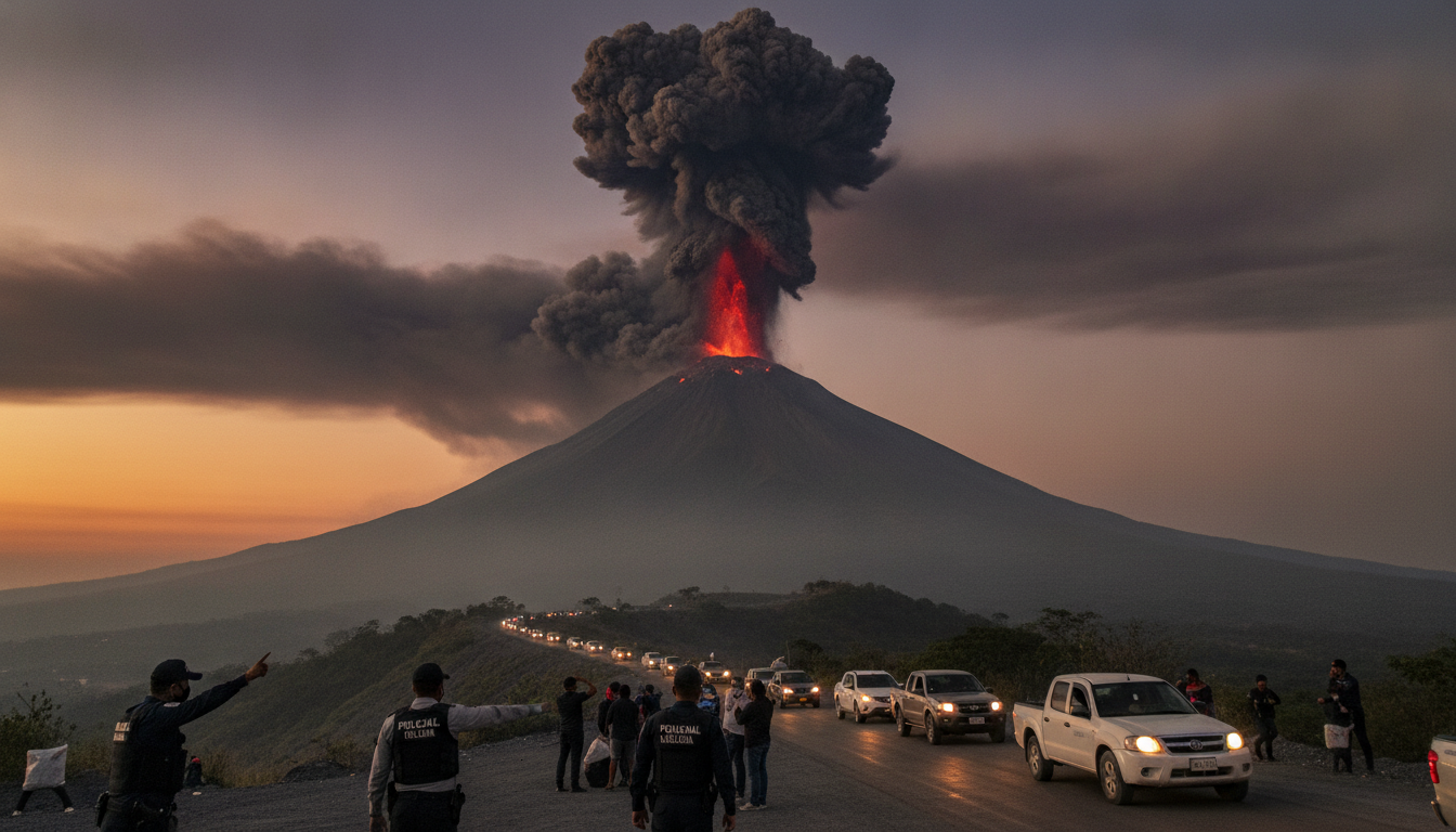
Fuego volcano eruption in Guatemala sends ash column 4–5 km as authorities order evacuations
Guatemala’s Fuego volcano eruption has propelled an ash and gas column 4–5 kilometres into the sky, prompting an orange alert and the evacuation of nearby villages as authorities warn residents to avoid the volcano and surrounding ravines.
Residents near the Fuego volcano, located about 40 kilometres southwest of Guatemala City, were evacuated on Tuesday after the volcano expelled a plume of ash, gases and volcanic fragments rising between 4 and 5 kilometres above the summit.
Local emergency services established temporary shelters for displaced families and public schools suspended classes while officials assessed immediate risks.
Evacuations and sheltering of nearby communities
Local disaster coordination authorities ordered the first evacuations for communities closest to the volcano’s flanks and set up emergency reception centres.
People taken from the most exposed villages were directed to designated shelters where basic assistance and information were being provided.
Schools in affected municipalities were cancelled for the day to reduce exposure and allow authorities to focus on relief and monitoring operations.
Officials also advised residents to remain calm, carry essential documents, and follow instructions issued by civil protection and municipal authorities.
Ash plume, dispersion and transport disruption
The ash column from the Fuego volcano eruption reached altitudes of approximately 4–5 kilometres, and ash clouds have been observed drifting roughly 60 kilometres to the west.
Authorities reported that ash fall and reduced visibility have disrupted air traffic and ground transport in parts of Chimaltenango and Suchitepéquez departments.
Flights in the affected airspace experienced delays or suspensions as airport and aviation authorities adjusted operations to account for airborne ash, which poses hazards to aircraft engines and navigational visibility.
Local road travel was also hindered in areas with significant ash accumulation, prompting traffic advisories and clean-up preparations.
Alert levels and safety perimeter
Guatemala’s National Coordination for Disaster Reduction (CONRED) upgraded its status to an orange alert, classified as a “danger” level that sits below red in the national alert scale.
The alert triggered pre-established contingency measures designed to protect communities within the volcano’s immediate vicinity.
Seismology and civil protection authorities warned residents not to approach the volcano or descend into ravines on its southeast flank, areas particularly susceptible to pyroclastic flows and ballistic projectiles during eruptive episodes.
A safety radius of 10 kilometres around the summit was emphasised for heightened precautions and monitoring.
Scientific observations and current activity
The Institute of Seismology, Vulcanology, Meteorology and Hydrology of Guatemala (INSIVUMEH) said the Fuego volcano is passing through “its most intense phase” of activity in the present episode.
INSIVUMEH’s bulletins recommended that precautionary measures be observed for communities located within the 10‑kilometre hazard zone.
Fuego, which rises to roughly 3,800 metres, is part of the Pacific Ring of Fire and is one of Central America’s most active volcanoes.
Scientists continue to record ash emissions, seismicity and surface changes as they refine forecasts and advise emergency response agencies.
Historical eruptions and ongoing risk assessment
Fuego has a history of frequent eruptive behaviour and experienced two significant eruptions during the previous year, underscoring its potential for rapid escalation.
The volcano’s most catastrophic recent event occurred in 2018, when a violent eruption caused widespread devastation and resulted in approximately 200 fatalities.
That deadly 2018 eruption led Guatemalan authorities to strengthen monitoring networks, evacuation protocols and community preparedness measures around high‑risk volcanoes.
The current eruption has reactivated those systems and prompted renewed public information campaigns to reduce exposure and improve response times.
Communities downwind and officials monitoring air quality warned that ash can affect respiratory health, contaminate water supplies and damage crops and machinery, particularly if fall persists.
Response teams and municipal services are coordinating to mitigate those secondary impacts and to support families temporarily displaced by the eruption.
The situation remains dynamic as INSIVUMEH and CONRED continue to issue updates and assess the evolution of eruptive activity.
Authorities have urged residents to heed official instructions, avoid hazardous zones around the Fuego volcano and remain prepared for further developments while emergency services maintain readiness.
