
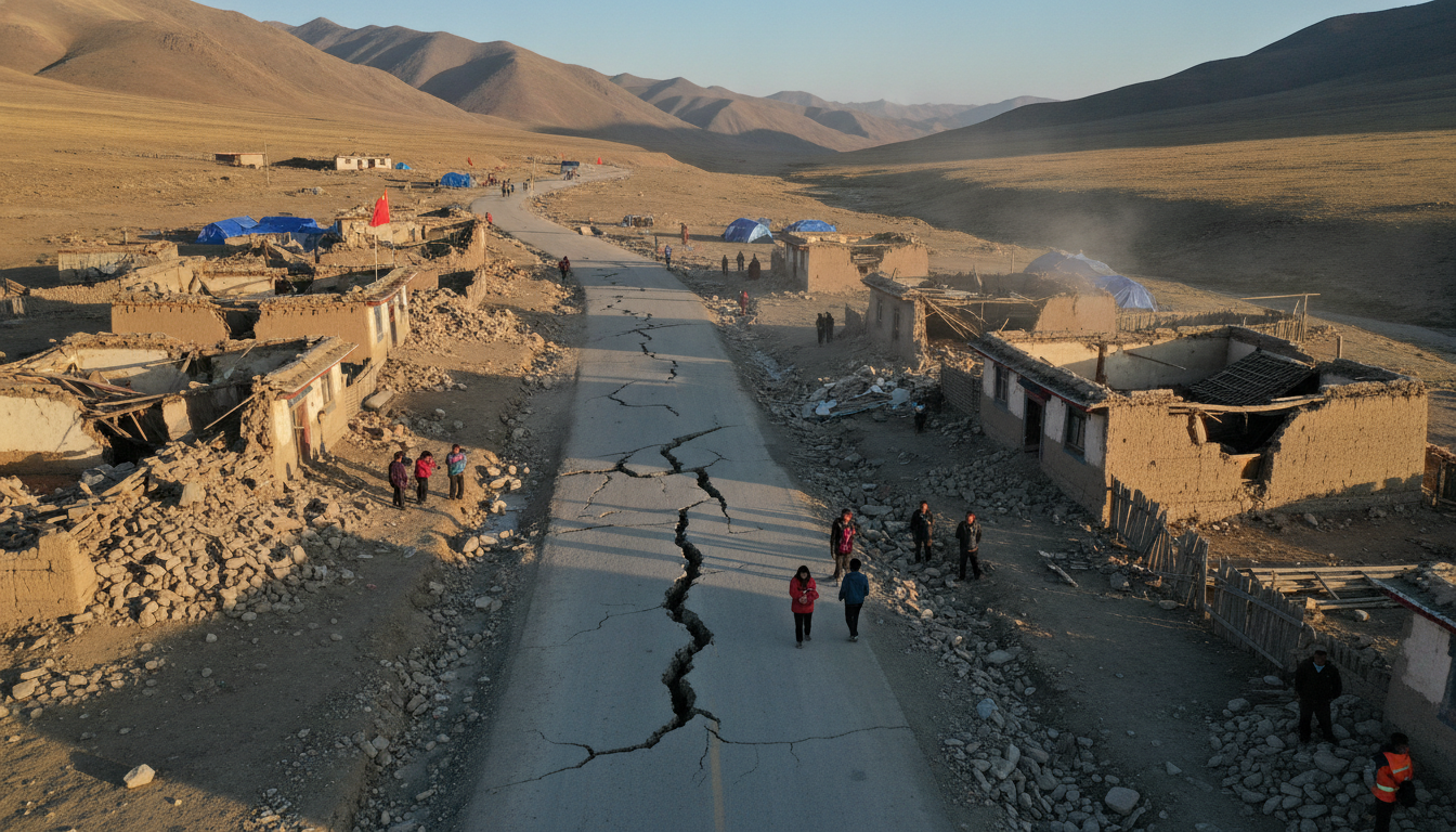
Qinghai earthquake: Two shocks of magnitude 5.7 and 5.8 hit Xinghai County, China
Two earthquakes measuring 5.7 and 5.8 struck Xinghai County in Qinghai province on Tuesday, the China Earthquake Networks Center reported; both quakes were shallow at 10 km depth and occurred near Xining. The Qinghai earthquake was first recorded at 11:16 a.m. local time (03:16 GMT), with a second, stronger shock 18 minutes later.
Two Shocks Strike Xinghai County
The China Earthquake Networks Center (CENC) recorded an initial magnitude-5.7 quake at 11:16 a.m. Beijing time, followed by a magnitude-5.8 event 18 minutes later. Both shocks were located at a shallow focal depth of 10 kilometres, intensifying ground motion near the epicentral area.
Local monitoring networks reported the epicentres were roughly 244 kilometres from Xining, the provincial capital of Qinghai, placing the events in a sparsely populated but seismically active part of the Tibetan Plateau. Officials said instruments immediately triggered routine alerts and further monitoring of seismic activity was underway.
Seismic Measurements and Monitoring
Seismologists characterized both tremors using standard magnitude scales and rapid automated analyses from regional stations, which provide near-real-time estimates. The identical depth readings suggest rupture occurred within the brittle crust, a factor that typically increases the felt intensity at the surface.
Monitoring agencies emphasized that magnitude estimates can be refined as additional seismic data are processed, and that aftershock sequences are commonly reassessed in the hours and days following such double events. National and provincial monitoring units remain on alert for further activity and will issue updates as new information becomes available.
Proximity to Xining and Local Geography
The epicentres were located about 244 kilometres from Xining, the administrative centre of Qinghai province, but the rugged terrain and high-altitude plateau between the epicentre and the capital can influence how shaking is transmitted. Xinghai County lies within a region of complex geology where crustal shortening and faulting associated with the Tibetan Plateau produce frequent seismicity.
Population density in the immediate epicentral area is relatively low compared with eastern China, but mountain villages and dispersed settlements may still experience strong shaking. Road and communications links in highland areas can be vulnerable to secondary effects such as rockfalls and landslides after strong tremors.
Reports on Damage and Casualties
As of initial reports, Chinese seismic authorities and local officials had not confirmed significant casualties or major structural damage tied to the two quakes. Emergency services typically prioritize rapid assessments of critical infrastructure, and provincial authorities said assessment teams were being mobilized to survey affected communities.
Residents in towns and villages near the epicentre described feeling strong, short-duration shaking, with some taking to open areas and roadways as a precaution. Local governments commonly advise citizens to report damage and avoid entering damaged buildings until inspections are completed.
Aftershock Risk and Public Safety Measures
Seismologists warned that aftershock activity is likely in the hours and days following the double shocks, with the potential for additional moderate tremors. Authorities urged residents to prepare for aftershocks by securing heavy objects, checking gas and electrical systems, and following instructions from local emergency coordinators.
Public safety messaging emphasized standard earthquake precautions: move to open ground if buildings feel unsafe, check for injuries and hazards, and keep communication lines open for official advisories. Relief and inspection teams were dispatched to monitor roads, bridges and public utilities for signs of damage that could affect transportation or access to services.
Context: Qinghai’s Seismic History
Qinghai province sits on the northeastern edge of the Tibetan Plateau and has a long history of seismic activity, including damaging events in past decades. The region’s tectonics are dominated by the ongoing collision between the Indian and Eurasian plates, which generates crustal deformation and periodic earthquakes across the plateau and adjacent ranges.
Past earthquakes have highlighted the vulnerability of remote highland communities to both shaking and secondary hazards such as landslides. Authorities and researchers continue to invest in seismic monitoring, early warning systems and public preparedness to reduce risk in this seismically active province.
The China Earthquake Networks Center and local Qinghai authorities said they will continue to update the public as more detailed assessments become available and as aftershock sequences evolve. The incidents serve as a reminder for residents and officials in western China to maintain preparedness measures in earthquake-prone areas.
